 Overview
This loop hike climbs to the summits of Green Pond and Island Pond Mountains, goes through the narrow Lemon Squeezer, and passes the historic Boston Mine.
Details
Time:
4.5 hours
Difficulty:
Moderate to Strenuous
Length:
7.5 miles
Route Type:
Circuit
Dogs:
Allowed on leash
Features:
Views, Public Transportation
Location
Park:
Region:
County:
Orange
State:
NY
First Published:
Updated/Verified:
Submitter:
Daniel Chazin
Photo
Trail Conference volunteers maintain trails in this park.
Trailhead GPS Coordinates
41.264792, -74.15426Driving Directions
Take N.Y. Route 17 north through Sloatsburg, Tuxedo and Southfields. About two miles north of Southfields, turn right onto Arden Valley Road. Cross the bridge over the New York State Thruway, then make the first right at a sign "Hikers' Trailhead Parking." Park in the dirt parking area to the west of a large meadow, known as the Elk Pen.
Bus
Take Shortline bus from Port Authority. Buy tickets to Southfields (round trip hikers discount of course), and ask the bus driver to let you off at Arden Valley Road next to a "Welcome to Harriman State Park" sign & a sign with a drawing of two hikers (a couple of miles north of the old Red Apple Rest). Return bus stops across the street - wave the driver down. After you get off the bus, make a right onto Arden Valley Rd., walk across the bridge over the NY State Thruway, then notice two white A.T. blazes under a sign that says "Rough Road next 5 miles ahead" indicating to turn into the woods. This takes you to a parking lot and on the other side of the lot slightly to the right, the trail continues through a field, then makes a right onto a woods road to an A.T. mile marker sign for Lemon Squeezer and other destinations.
 Description
From the parking area, follow an unmarked woods road east across the meadow. At the end of the meadow, you will notice three red-triangle-on-white blazes, which mark the start of the Arden-Surebridge (A-SB) Trail. Turn right and follow the A-SB Trail south for about 100 feet, where you will see a wooden sign giving mileages along the Appalachian Trail (A.T.). You will be following the A.T., marked with white blazes, for the next two and one-half miles of the hike. Turn left onto the A.T., which begins a steady ascent of Green Pond Mountain, first moderately, then more steeply. After a climb of over 500 vertical feet, you'll reach the summit of the mountain, where a large boulder to the left of the trail affords limited views to the west. The A.T. now descends the eastern slope of the mountain on switchbacks.
At the base of the descent, follow the A.T. as it turns left onto Island Pond Road, a dirt road built by Edward Harriman (after whom the park is named) about 1905. You'll soon enter a beautiful hemlock grove. After only about 500 feet on Island Pond Road, the A.T. turns right, goes over a small rise, and crosses a gravel road built in the 1960s to provide access for fishermen to Island Pond. The trail descends to cross an outlet of the pond on a small wooden bridge. The stone spillway you see was built by Civilian Conservation Corps workers in the mid-1930s as part of a plan to increase the size of Island Pond by damming it. The work was never completed, though, and the pond remains in its natural state.
The A.T. now ascends to a knoll overlooking beautiful Island Pond. On the way, you will pass a large rusted metal object to the right. This was a rotary gravel sorter, used to separate different sizes of gravel. The trail then descends and turns right on another woods road, known as the Crooked Road. After a short distance, the white blazes leave to the left and climb to a junction with the A-SB Trail, marked with red triangles on a white background. Turn left at the junction and follow the joint A.T./A-SB to the base of a large rock formation, where the two trails split.
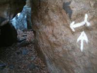
This rock formation, known as the Lemon Squeezer, is one of the most interesting features of the park. Turn left and follow the A.T. as it climbs through a very narrow passage between the rocks and then goes up a steep rock face, where you will need to use both your hands and your feet. Those who are physically able to negotiate these challenges will find them to be a highlight of the hike. But if the climb is too difficult, it is possible to bypass the Lemon Squeezer by following a path to the left.
After reaching the top of the Lemon Squeezer, the A.T. continues on a more moderate grade to the summit of Island Pond Mountain. The stone ruins just north of the summit are the remains of a cabin built by Edward Harriman. This is a good place to stop and take a break.
The A.T. descends from the mountain and enters an attractive hemlock grove. After winding through the hemlocks, you will reach a junction with the aqua-blazed Long Path, marked by a wooden signpost. Turn right, leaving the A.T., and follow the Long Path as it skirts the edge of Dismal Swamp. The ridge visible across the swamp to the east is Surebridge Mountain. A short distance beyond a wet area, crossed on tree roots, you will come to a woods road - the route of the A-SB Trail (now encountered for the third time). Cross the road and bear left, where you will see three horizontal white blazes, marking the start of the White Bar Trail. Continue ahead on the White Bar Trail, which briefly joins a woods road, then turns left on a wider woods road - the continuation of the Crooked Road that you followed earlier in the hike.
RELATED VIDEO


