Bear Mountain (2, 316 ft.) is the highest peak in
Connecticut. It is not, however, the highest point of land in
Connecticut. The highest point is 2, 380 feet, found on the south slope of
Mt.
Frissell whose 2, 453 ft. summit lies in
Massachusetts. Nonetheless, Bear Mountain maintains its distinction as the highest summit in
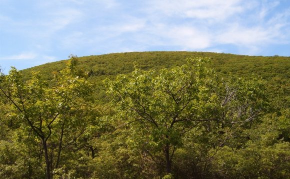
Connecticut and it offers one of the prettiest vistas in the state. It's a beautiful hike on the Appalachian Trail south of the summit because you're hiking on rocks, surrounded by low bushes (including blueberries!), and the view progressively opens up for you. A stone pyramid built in 1885, about 8 feet high with a flat top, sits on the summit and provides a great platform for checking out the panorama. Prominently to the north in
Massachusetts are Mts. Race (to the right) and Everett (to the left). To the east, you look down into the valley where the
Twin
Lakes are. To the west is
Frissell and to the southwest is
Gridley. Heading north on the Appalachian Trail drops you into Sages Ravine and the
Massachusetts border (just over a mile away).
After your hike, be sure to check out the town of
Salisbury. It's a classy, little
Connecticut town. In
Salisbury center, all within a stone's throw from each other are the Village Store for hiking supplies and Epicure Market for sandwiches and refreshments.
Preplanned Hike
Mileage
0 Undermountain Trail parking lot
1.1 Junction of Undermountain Trail & Paradise Lane Trail
3.2 Junction of Paradise Lane Trail & Appalachian Trail
3.9
Bear Mountain summit
4.8 Junction of Appalachian Trail & Undermountain Trail
5.6 Junction of Undermountain Trail & Paradise Lane Trail
6.7 Undermountain Trail parking lot
The Hike
This hike begins at the rock on the right side of the Undermountain Trail parking lot (with your back to the road). Proceed from the rock to the bulletin board in the woods. If you're interested, there are usually pamphlets about the Connecticut Appalachain Trail available here. Also, there is a wooden outhouse nearby if nature calls (you must provide your own TP). Head straight from the bulletin board up the broad, blue blazed Undermountain Trail. You are walking on a forested, moderately steep, well-maintained path. Eventually you will come to a sign welcoming you to
Appalachian Trail lands. Soon thereafter a brook appears on your left and you come to the junction of the Undermountain Trail and
Paradise
Lane
Trail.
Turn right onto the
Trail and continue to follow blue blazes. This trail is mostly flat and easy hiking. You will soon pass
Paradise Lane group camping area on your right. Then on your left you will come to a picturesque swamp where you may hear bull frogs croaking as I did. Further on your left you come to an opening that offers a view ofBear Mountain. Ultimately you arrive at the junction of the
Trail and the
Appalachian Trail. If you're looking for a place to camp, head down to Sages Ravine where there are tent sites within a mile along the river. In the summer, there is a caretaker and fee for camping.
RELATED VIDEO


RELATED FACTS
-
 Bear Mountain, is a prominent peak of the southern Taconic Mountains. It lies within the town of Salisbury, Connecticut, in the United States, and is the highest mountain summit in the state of Connecticut. The highest point in the state, however, is located on the...
-
 Connecticut (/kəˈnɛtɨkət/) is a state in the New England region of the northeastern United States. It is bordered by Rhode Island to the east, Massachusetts to the north, and the state of New York to the west and the south (with which it shares a water boundary in...
Share this Post
latest post
-
 Bear Mountain Inn Reviews July 20, 2024
 -
 Bear Mountain Discount lift tickets July 10, 2024
 -
 Bear Mountain tickets Deals June 30, 2024
 -
 Bear Mountain California Map June 20, 2024
 -
 Bear Lodge Mountains Wyoming June 10, 2024
 -
 Bear Mountain Season Passes May 31, 2024
 -
 Bear Mountain New York hiking May 21, 2024
 -
 Big Bear Mountain weather 10 day forecast May 11, 2024
 -
 Bear Mountain Coupons May 1, 2024